• Younger Dryas wetland stand between the Calumet Beach and Glenwood Beach (the Lake Chicago shorelines)
• Climate tree-ring proxies of Younger Dryas from Indiana
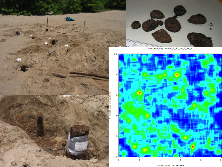
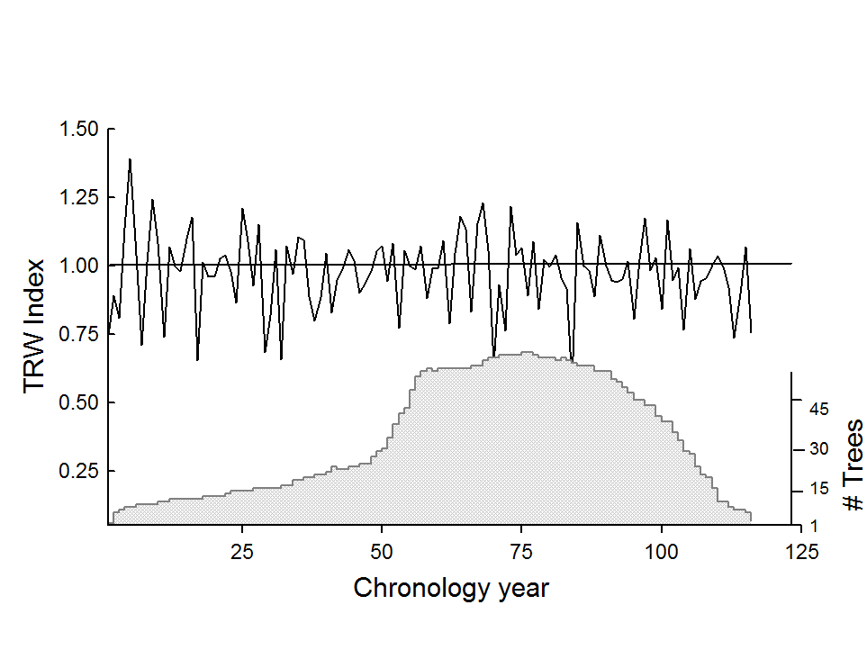
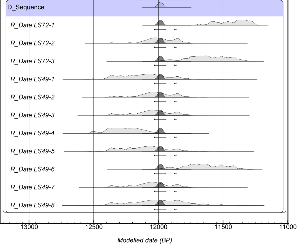
The Liverpool (East) Site is located ca. 2 mi (ca. 3 km) southeast of Gary, Indiana. Stumps from the forest are rooted in the upper surface of a continuous, thin peat bed (10-30 cm thick) sandwiched between sand deposits about 7 km south of Lake Michigan. Since 2003, we have collected more than 130 pieces of wood after excavating through the surface sand cover, ca. 73 of which are cross-sections from stumps. Typical distance separation of trees observed visually and by ground penetrating radar (Fig. ) was about 1-3 m, indicating conifer woodland with some overlapping canopies. The moist, lowland environment suggested by the peat, Picea sp. wood identification, and the appearance of the few recovered small rounded spruce cones from the upper level of the peat, imply this was a Picea mariana (Mill.) B.S.P. (black spruce) forest. The majority of stumps tilt to the southeast (Fig.), perhaps in response to the effect of northwesterly winds on trees rooted on the soft wetland substrate. Furthermore, the tops of most stumps seem to be truncated at a uniform height (20-40cm) above the peat (Fig.), and the corresponding tree tops do not seem to be present in the upper sand deposit. The first glimpse of N. American Younger Dryas conditions at annual resolution is revealed in wood from this buried forest in northwestern Indiana whose ages cluster between 10,040 and 10,445 14C y BP (11,400-12,500 Cal y BP). The black spruce forest existed for almost 120 years with two waves of recruitment punctuated by intervals of stressful growth. Interannual variability of tree-ring records suggests a cold and wet climate, with trees experiencing frost events, tilting, drowning and burial in lacustrine sands of a rising paleo-Lake Michigan as the Laurentide ice sheet deteriorated, and ultimately shearing of their tops after death, perhaps by lake ice. Reference: Panyushkina I.P., Leavitt S.W., Schneider A.F., Thompson T.A., Lange T. 2008. Environment and paleoecology of a 12 ka mid-North American Younger Dryas forest chronicled in tree rings. Quaternary Research 70: 433-441.