• Mid Holocene riparian forest
• Younger Dryas riparian forest
• No-analog vegetation from central Illinois
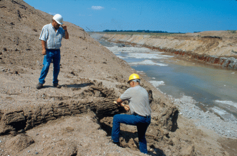
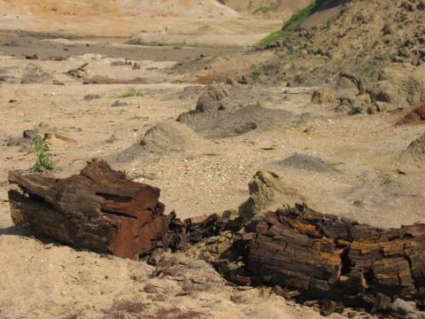
The Lincoln Quarry site is located ca. 4 mi (ca. 6 km) west of Lincoln (Illinois) in the Holocene floodplain of Salt Creek. The valley lies in the Illinois Till Plain. End moraines from the last glaciation, also drained by Salt Creek, occur about 20 km to the east. We visited the site on 10 August, 2001 and 22 May 2003, and a major wood collection was conducted on June 2, 2005, after a flood in January had exposed many logs that became easily accessible. The wood is preserved in gravel-bearing sandy alluvium typically 5 to 10 m thick, sandwiched by 1- to 5-m-thick silty overbank deposits above and mid-Wisconsin deposits below, including the wood- bearing Robein Member of the Roxana Silt that dates at about 26,000 BP. The Quaternary deposits occur above Pennsylvanian limestone. The wood is contained in alluvial sands that rest on top of the dolomite strata being quarried at the site. We sampled about 30 logs or log fragments in this deposit. The assemblage of wood represents hardwood (angiosperm) trees, and the ring-width characteristics are favorable to developing formal tree-ring chronologies. However, 4 new radiocarbon dates indicate deposition of wood may have taken place over at least 8000 14C yr (6000–14,000 BP). This complicates the effort to develop a single floating chronology of several hundred years at this site, but it may provide wood from a restricted region over a long period of time from which to develop a sequence of floating chronologies, the timing of deposition and preservation of which could be related to paleoclimatic events and conditions. Reference: Panyushkina I.P., Leavitt S.W., Wiedenhoeft A., Noggle S., Curry B., Grimm E. 2004. Tree-ring records of near-Younger Dryas time in Central North America- preliminary results from the Lincoln quarry site, central Illinois, USA. Radiocarbon 46 (2): 933-941.


